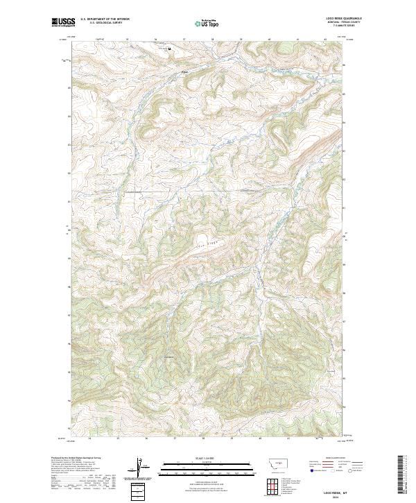
2024 Map of Loco Ridge
USGS Topo · Published 2024About this map
Great Divide Cem stands as a quiet landmark in the northern reaches of this Fergus County landscape, situated just north of the settlement at Piper. The terrain is defined by the prominent uplift of Loco Ridge, which bisects the quadrangle and influences the local drainage patterns. To the north, the South Fork McDonald Creek and Duncan Creek carve through the foothills, while the southern portion of the map is dominated by the broad expanse of Gyp Basin and the headwaters of Tyler Creek. The presence of Lyons Butte in the southeast corner provides a distinct vertical marker against the surrounding basin. This area reflects a classic Montana ranching landscape where secondary roads like Alaska Bench Rd and Tyler Creek Rd follow the natural contours of the drainages and ridges to connect isolated settlements and landholdings.
Find a feature on this map
18 named features on this map. Tap any name to fly to it.
Don’t see what you’re looking for? This feature index may not catch every label — zoom into the map to look around manually.
Map Details
Editions of this 2024 Loco Ridge Map
This is the sole edition of this map. No revisions or reprints were ever made.
Other maps of this area

1889 · Big Snowy Mountain
USGS Topo · 1:250,000

1893 · Big Snowy Mountain
USGS Topo · 1:250,000

1941 · Lewistown
USGS Topo · 1:62,500

1941 · Judith Peak
USGS Topo · 1:62,500

1944 · Lewistown
USGS Topo · 1:62,500

1944 · Judith Peak
USGS Topo · 1:62,500

1954 · Roundup
USGS Topo · 1:250,000

1954 · Lewistown
USGS Topo · 1:250,000

1958 · Roundup
USGS Topo · 1:250,000

1959 · Lewistown
USGS Topo · 1:250,000