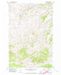
1970 Map of Loco Ridge
USGS Topo · Published 1974About this map
Piper and Alaska serve as the primary human touchpoints in this 1970 landscape of central Montana, where the Chicago Milwaukee St Paul and Pacific railroad cuts across the northern terrain. The infrastructure of the era is evidenced by a Gravel Pit and a small Cem located near the tracks, while the land itself is defined by the prominent Loco Ridge and Lyons Butte. Drainage patterns are clearly marked by McDonald Creek and its many tributaries, including Duncan Creek and Tyler Creek. The southern portion of the map transitions into the high-relief West Fork Gyp Basin, showing a sparsely populated territory where cattle ranching and transportation historically dictated the location of named sites. Numerous unnamed springs appear throughout the hills, highlighting the critical importance of water sources in this dry, elevated region.
Find a feature on this map
14 named features on this map. Tap any name to fly to it.
Don’t see what you’re looking for? This feature index may not catch every label — zoom into the map to look around manually.
Map Details
Editions of this 1970 Loco Ridge Map
This is the sole edition of this map. No revisions or reprints were ever made.
Other maps of this area

1889 · Big Snowy Mountain
USGS Topo · 1:250,000

1893 · Big Snowy Mountain
USGS Topo · 1:250,000

1941 · Lewistown
USGS Topo · 1:62,500

1941 · Judith Peak
USGS Topo · 1:62,500

1944 · Lewistown
USGS Topo · 1:62,500

1944 · Judith Peak
USGS Topo · 1:62,500

1954 · Roundup
USGS Topo · 1:250,000

1954 · Lewistown
USGS Topo · 1:250,000

1958 · Roundup
USGS Topo · 1:250,000

1959 · Lewistown
USGS Topo · 1:250,000