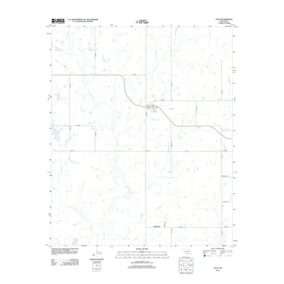
2012 Map of Loco
USGS Topo · Published 2012About this map
Loco sits at the intersection of a sprawling rural road network in Stephens County, characterized by a grid of section lines including E1850 Rd and N2980 Rd. The town center is defined by local streets such as Elm Ave and 8th St, while the nearby Loco Cem serves as a primary genealogical landmark for the area. The landscape is deeply carved by numerous watercourses, most notably Mountain Cr and Negro Cr, which drain the surrounding cattle and oil country.
Find a feature on this map
28 named features on this map. Tap any name to fly to it.
Don’t see what you’re looking for? This feature index may not catch every label — zoom into the map to look around manually.
Map Details
Editions of this 2012 Loco Map
This is the sole edition of this map. No revisions or reprints were ever made.
Other maps of this area

1901 · Addington
USGS Topo · 1:125,000

1957 · Ardmore
USGS Topo · 1:250,000

1962 · Ryan
USGS Topo · 1:62,500

1963 · Ardmore
USGS Topo · 1:250,000

1963 · Harrisburg
USGS Topo · 1:24,000

1964 · Comanche SE
USGS Topo · 1:24,000

1974 · Ringling NW
USGS Topo · 1:24,000

1974 · Loco
USGS Topo · 1:24,000
1974 · Ratliff City
USGS Topo · 1:24,000
1974 · Cottonwood Creek
USGS Topo · 1:24,000