
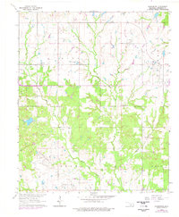
1963 Map of Harrisburg
USGS Topo · Published 1964About this map
Harrisburg stands as a focal point in this Stephens County landscape, where the agricultural traditions of the Oklahoma plains meet the intensive resource extraction of the mid-20th century. The terrain is defined by the drainage systems of West Mud Creek and East Mud Creek, which cut through a region heavily utilized for petroleum production. Industrial activity is prominent, with the Northwest Velma Oil Field, Velma Oil Field, and Palacine Oil Field dotting the map with numerous oil wells. This juxtaposition of industrial infrastructure and rural life is further evidenced by several Gravel Pits operating near the waterways.
Find a feature on this map
21 named features on this map. Tap any name to fly to it.
Don’t see what you’re looking for? This feature index may not catch every label — zoom into the map to look around manually.
Map Details
Editions of this 1963 Harrisburg Map
2 editions found
Other maps of this area

1901 · Addington
USGS Topo · 1:125,000

1902 · Rush Springs
USGS Topo · 1:125,000

1950 · Marlow
USGS Topo · 1:62,500

1951 · Marlow
USGS Topo · 1:62,500

1957 · Ardmore
USGS Topo · 1:250,000

1963 · Ardmore
USGS Topo · 1:250,000

1964 · Comanche SE
USGS Topo · 1:24,000

1964 · Duncan South
USGS Topo · 1:24,000

1964 · Comanche
USGS Topo · 1:24,000

1974 · Loco
USGS Topo · 1:24,000