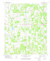
1974 Map of Ratliff City
USGS Topo · Published 1977About this map
Ratliff City and the surrounding energy-producing landscape of southern Oklahoma dominate this mid-1970s survey. The map details an area defined by its petroleum infrastructure, featuring the expansive Graham Oil Field, Loco Oil Field, and Parks Oil Field. Numerous extraction sites and utility markings, including Refinery and Substation labels, illustrate the industrial character of the region.
Find a feature on this map
21 named features on this map. Tap any name to fly to it.
Don’t see what you’re looking for? This feature index may not catch every label — zoom into the map to look around manually.
Map Details
Editions of this 1974 Ratliff City Map
This is the sole edition of this map. No revisions or reprints were ever made.
Other maps of this area

1898 · Pauls Valley
USGS Topo · 1:125,000

1901 · Addington
USGS Topo · 1:125,000

1901 · Ardmore
USGS Topo · 1:125,000

1902 · Pauls Valley
USGS Topo · 1:125,000

1902 · Rush Springs
USGS Topo · 1:125,000

1918 · Ardmore
USGS Topo · 1:125,000

1957 · Ardmore
USGS Topo · 1:250,000

1963 · Ardmore
USGS Topo · 1:250,000
1969 · Elmore City South
USGS Topo · 1:24,000
1969 · Tatums
USGS Topo · 1:24,000