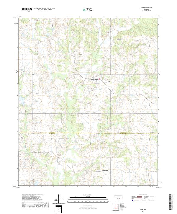
2022 Map of Loco
USGS Topo · Published 2022About this map
The settlement of Loco serves as the focal point of this southwestern Oklahoma landscape, positioned near the intersection of 1st St, 2nd St, and East St. The terrain is defined by a dendritic network of streams, including Pine Creek, Negro Creek, and Mountain Creek, which feed into several numbered water bodies such as 137056 Reservoir and 137059 Reservoir. These features suggest a landscape managed for local water needs amidst the rolling prairies.
Find a feature on this map
38 named features on this map. Tap any name to fly to it.
Don’t see what you’re looking for? This feature index may not catch every label — zoom into the map to look around manually.
Map Details
Editions of this 2022 Loco Map
This is the sole edition of this map. No revisions or reprints were ever made.
Other maps of this area

1901 · Addington
USGS Topo · 1:125,000

1957 · Ardmore
USGS Topo · 1:250,000

1962 · Ryan
USGS Topo · 1:62,500

1963 · Ardmore
USGS Topo · 1:250,000

1963 · Harrisburg
USGS Topo · 1:24,000

1964 · Comanche SE
USGS Topo · 1:24,000

1974 · Ringling NW
USGS Topo · 1:24,000

1974 · Loco
USGS Topo · 1:24,000
1974 · Ratliff City
USGS Topo · 1:24,000
1974 · Cottonwood Creek
USGS Topo · 1:24,000