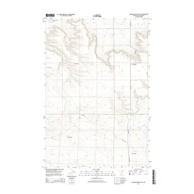
2014 Map of Locomotive Butte SE
USGS Topo · Published 2014About this map
Big Coulee Cr and Sixshooter Cr define the drainage patterns of this Stillwater County landscape, where the high plains are segmented by a network of ranch-access roads. The presence of the Three Cross Ranch Airport in the northwest corner highlights the importance of private aviation in managing these expansive land holdings. Land use is organized around the Public Land Survey System, with boundaries for t4n r19e, t4n r20e, t3n r19e, and t3n r20e clearly demarcated. The road network, including Hines Ranch Rd and Big Coulee Rd, follows both the natural coulees and the rigid section lines of the range, providing a clear view of the rural infrastructure supporting Montana's modern ranching economy.
Find a feature on this map
15 named features on this map. Tap any name to fly to it.
Don’t see what you’re looking for? This feature index may not catch every label — zoom into the map to look around manually.
Map Details
Editions of this 2014 Locomotive Butte SE Map
This is the sole edition of this map. No revisions or reprints were ever made.
Other maps of this area

1889 · Big Snowy Mountain
USGS Topo · 1:250,000

1892 · Stillwater
USGS Topo · 1:125,000

1893 · Big Snowy Mountain
USGS Topo · 1:250,000

1954 · Billings
USGS Topo · 1:250,000

1954 · Roundup
USGS Topo · 1:250,000

1955 · Russell Gulch
USGS Topo · 1:24,000

1956 · Rapelje
USGS Topo · 1:24,000

1956 · Battle Butte
USGS Topo · 1:24,000

1957 · Billings
USGS Topo · 1:250,000

1958 · Billings
USGS Topo · 1:250,000