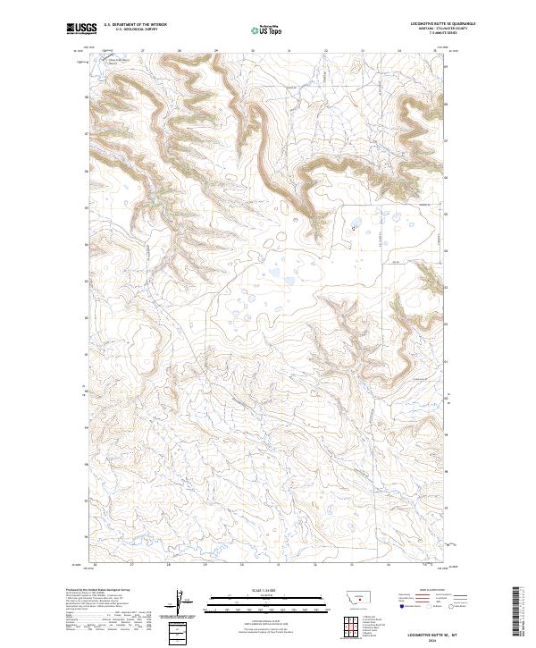
2024 Map of Locomotive Butte SE
USGS Topo · Published 2024About this map
Sixshooter Creek winds through the southern reaches of this landscape in Stillwater County, providing a vital water source in a region defined by extensive coulees and high plateaus. The placement of the Three Cross Ranch Airport in the northwest corner highlights the importance of private aviation for modern ranching operations in these expansive Montana spaces. The local road network, including Big Coulee Rd and Hines Ranch Rd, follows the natural contours of the terrain, tracing the paths between highland ridges and the deep drainages that characterize the northern and central portions of the quadrangle. This 2024 survey details the contemporary layout of large ranching tracts, where names like Herzog Rd and Meins Rd reflect the enduring footprint of local families on the land.
Find a feature on this map
13 named features on this map. Tap any name to fly to it.
Don’t see what you’re looking for? This feature index may not catch every label — zoom into the map to look around manually.
Map Details
Editions of this 2024 Locomotive Butte SE Map
This is the sole edition of this map. No revisions or reprints were ever made.
Other maps of this area

1889 · Big Snowy Mountain
USGS Topo · 1:250,000

1892 · Stillwater
USGS Topo · 1:125,000

1893 · Big Snowy Mountain
USGS Topo · 1:250,000

1954 · Billings
USGS Topo · 1:250,000

1954 · Roundup
USGS Topo · 1:250,000

1955 · Russell Gulch
USGS Topo · 1:24,000

1956 · Rapelje
USGS Topo · 1:24,000

1956 · Battle Butte
USGS Topo · 1:24,000

1957 · Billings
USGS Topo · 1:250,000

1958 · Billings
USGS Topo · 1:250,000