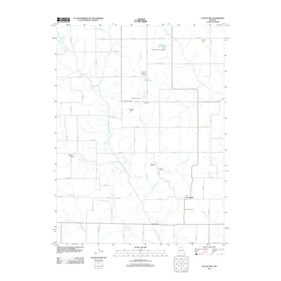
2012 Map of Locust Hill
USGS Topo · Published 2012About this map
Locust Hill serves as a central anchor for this Missouri landscape, situated where the North Fork Salt River and Black Creek define the drainage patterns of the region. The map reveals a deeply rooted rural community, marked by a high density of family and community burial grounds including Mount Taber Cemetery, Landsberry Cemetery, and Epperson Cemetery. These sites, along with the Locust Hill Cemetery, provide significant data for genealogical research in Knox County.
Find a feature on this map
75 named features on this map. Tap any name to fly to it.
Don’t see what you’re looking for? This feature index may not catch every label — zoom into the map to look around manually.
Map Details
Editions of this 2012 Locust Hill Map
This is the sole edition of this map. No revisions or reprints were ever made.
Other maps of this area

1903 · Edina
USGS Topo · 1:125,000

1908 · Atlanta
USGS Topo · 1:62,500

1953 · Moberly
USGS Topo · 1:250,000

1954 · Centerville
USGS Topo · 1:250,000

1954 · Moberly
USGS Topo · 1:250,000

1957 · Moberly
USGS Topo · 1:250,000

1957 · Centerville
USGS Topo · 1:250,000

1958 · Centerville
USGS Topo · 1:250,000

1960 · Moberly
USGS Topo · 1:250,000
1963 · Leonard
USGS Topo · 1:24,000