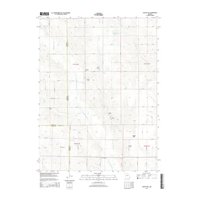
2015 Map of Locust Hill
USGS Topo · Published 2015About this map
The North Fork Salt River and Little Fabius River define the agricultural landscape of northern Missouri where the borders of Knox, Adair, and Macon counties converge. This 2015 survey of the Locust Hill area shows a region shaped by small family-named landmarks and watercourses like Shelton Br and Twomile Cr. For local historians and genealogists, the map is particularly valuable for its documentation of several rural burial grounds, including the Landsberry Cemetery, Mount Taber Cemetery, Epperson Cemetery, and Shelton Cemetery. The presence of the Harrison Airport and Feltz's Bridge highlights the infrastructure connecting these rural homesteads. The topography is further characterized by local features such as Spencer Draw and man-made water bodies like Hurdland Severs Lake and Gelbach Farms Lake, illustrating the intersection of natural drainage and modern land use.
Find a feature on this map
82 named features on this map. Tap any name to fly to it.
Don’t see what you’re looking for? This feature index may not catch every label — zoom into the map to look around manually.
Map Details
Editions of this 2015 Locust Hill Map
This is the sole edition of this map. No revisions or reprints were ever made.
Other maps of this area

1903 · Edina
USGS Topo · 1:125,000

1908 · Atlanta
USGS Topo · 1:62,500

1953 · Moberly
USGS Topo · 1:250,000

1954 · Centerville
USGS Topo · 1:250,000

1954 · Moberly
USGS Topo · 1:250,000

1957 · Moberly
USGS Topo · 1:250,000

1957 · Centerville
USGS Topo · 1:250,000

1958 · Centerville
USGS Topo · 1:250,000

1960 · Moberly
USGS Topo · 1:250,000
1963 · Leonard
USGS Topo · 1:24,000