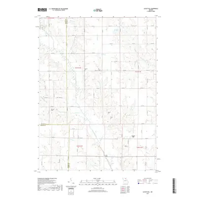
2017 Map of Locust Hill
USGS Topo · Published 2017About this map
The Locust Hill area of Knox County is defined by its rural cemetery network and the intricate drainage of the North Fork Salt River. This landscape reflects a longstanding agricultural tradition, where small family and community burial grounds like Lansberry Cem, Mount Tabor Cem, and Epperson Cem are situated on the higher ground overlooking the river valleys. The meeting of three counties — Adair, Macon, and Knox — occurs in the southwest corner of this map, highlighting the political geography that has influenced local land ownership and road development for generations.
Find a feature on this map
87 named features on this map. Tap any name to fly to it.
Don’t see what you’re looking for? This feature index may not catch every label — zoom into the map to look around manually.
Map Details
Editions of this 2017 Locust Hill Map
This is the sole edition of this map. No revisions or reprints were ever made.
Other maps of this area

1903 · Edina
USGS Topo · 1:125,000

1908 · Atlanta
USGS Topo · 1:62,500

1953 · Moberly
USGS Topo · 1:250,000

1954 · Centerville
USGS Topo · 1:250,000

1954 · Moberly
USGS Topo · 1:250,000

1957 · Moberly
USGS Topo · 1:250,000

1957 · Centerville
USGS Topo · 1:250,000

1958 · Centerville
USGS Topo · 1:250,000

1960 · Moberly
USGS Topo · 1:250,000
1963 · Leonard
USGS Topo · 1:24,000