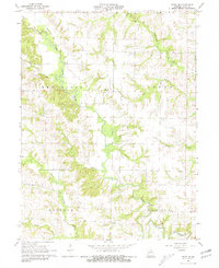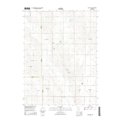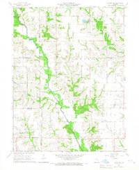
1965 Map of Locust Hill
USGS Topo · Published 1967About this map
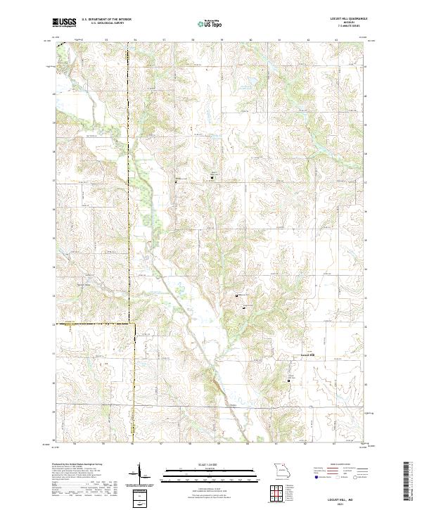
The North Fork Salt River meanders across this rural landscape at the intersection of Adair, Knox, and Macon Counties. The settlement of Locust Hill serves as a local focal point, surrounded by numerous small family and community burial grounds including Epperson Cem, Landsberry Cem, and Shelton Cem. The geography is defined by a dense network of watercourses, with Little Fabius River and Muddy Creek cutting through the township divisions of Wilson, Shelton, and Johnston. An Old Railroad Grade remains visible on the landscape, tracing a path south of Locust Hill Cem, while rural spiritual life is represented by Mt Taber Ch and New Harmony Ch. The presence of these scattered cemeteries and the decommissioned rail line provides significant evidence of earlier settlement patterns and local transit history in Northeast Missouri.
Find a feature on this map
26 named features on this map. Tap any name to fly to it.
Don’t see what you’re looking for? This feature index may not catch every label — zoom into the map to look around manually.
Map Details
Editions of this 1965 Locust Hill Map
This is the sole edition of this map. No revisions or reprints were ever made.
Historical Maps of Locust Hill Through Time
10 maps found