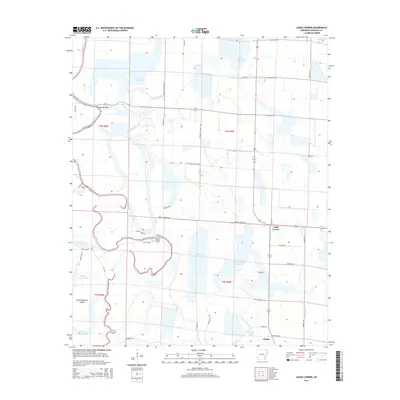
2014 Map of Lodge Corner
USGS Topo · Published 2014About this map
Bayou Meto meanders through this agricultural landscape in Arkansas County, defining the drainage patterns and historical property boundaries of the region. The settlement of Lodge Corner serves as a local hub near the intersection of Lodges Corner Rd and Highway 152, surrounded by a complex system of water management features including Hamptons Reservoir, Wilson Reservoir, and Cox Reservoir. These man-made basins, alongside natural features like King Bayou and Pecan Bayou, underscore the area's intensive irrigation and rice-farming heritage.
Find a feature on this map
53 named features on this map. Tap any name to fly to it.
Don’t see what you’re looking for? This feature index may not catch every label — zoom into the map to look around manually.
Map Details
Editions of this 2014 Lodge Corner Map
This is the sole edition of this map. No revisions or reprints were ever made.
Other maps of this area

1935 · Varner
USGS Topo · 1:62,500

1935 · Gillett
USGS Topo · 1:62,500

1941 · De Witt
USGS Topo · 1:62,500

1941 · Goldman
USGS Topo · 1:62,500

1948 · Helena
USGS Topo · 1:250,000

1950 · Helena
USGS Topo · 1:250,000

1954 · De Witt
USGS Topo · 1:62,500

1955 · Helena
USGS Topo · 1:250,000

1959 · Helena
USGS Topo · 1:250,000

1960 · Helena
USGS Topo · 1:250,000