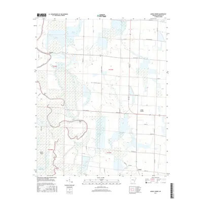
2017 Map of Lodge Corner
USGS Topo · Published 2017About this map
Bayou Meto meanders through the heart of Arkansas County, defining a landscape shaped by water and agriculture. This region, characterized by extensive wetlands and rice production infrastructure, features numerous water management sites such as Wilson Reservoir and Hamptons Reservoir. Small rural settlements like Lodge Corner and Hagler serve as local hubs for the surrounding farmsteads. The importance of historical transit across the bayous is evident in the marking of Youngblood Bridge and Benson Bridge.
Find a feature on this map
48 named features on this map. Tap any name to fly to it.
Don’t see what you’re looking for? This feature index may not catch every label — zoom into the map to look around manually.
Map Details
Editions of this 2017 Lodge Corner Map
This is the sole edition of this map. No revisions or reprints were ever made.
Other maps of this area

1935 · Varner
USGS Topo · 1:62,500

1935 · Gillett
USGS Topo · 1:62,500

1941 · De Witt
USGS Topo · 1:62,500

1941 · Goldman
USGS Topo · 1:62,500

1948 · Helena
USGS Topo · 1:250,000

1950 · Helena
USGS Topo · 1:250,000

1954 · De Witt
USGS Topo · 1:62,500

1955 · Helena
USGS Topo · 1:250,000

1959 · Helena
USGS Topo · 1:250,000

1960 · Helena
USGS Topo · 1:250,000