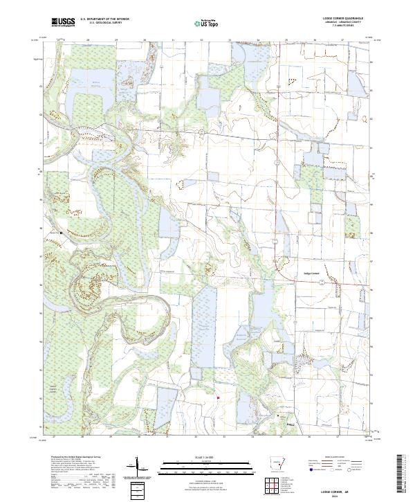
2024 Map of Lodge Corner
USGS Topo · Published 2024About this map
Bayou Meto meanders through this agricultural landscape in Arkansas County, defining the drainage patterns for the surrounding bottomlands and reservoirs. The small settlements of Lodge Corner and Hagler serve as local hubs in a region dominated by water management and farming, evidenced by the numerous named basins including Wilson Reservoir, Cox Reservoir, and Hamptons Reservoir. These engineered water bodies sit alongside natural features like Grand Cypress Lake and Horseshoe Lake, illustrating the sophisticated irrigation infrastructure required for the area's rice and soybean production. For the genealogist or local historian, the map preserves the location of Bayless Cem and Billings Cem, as well as several family-named roads such as Vallier Rd, George Dunklin Ln, and Noryce Ln that indicate the deep-rooted landownership patterns of this delta region.
Find a feature on this map
49 named features on this map. Tap any name to fly to it.
Don’t see what you’re looking for? This feature index may not catch every label — zoom into the map to look around manually.
Map Details
Editions of this 2024 Lodge Corner Map
This is the sole edition of this map. No revisions or reprints were ever made.
Other maps of this area

1935 · Varner
USGS Topo · 1:62,500

1935 · Gillett
USGS Topo · 1:62,500

1941 · De Witt
USGS Topo · 1:62,500

1941 · Goldman
USGS Topo · 1:62,500

1948 · Helena
USGS Topo · 1:250,000

1950 · Helena
USGS Topo · 1:250,000

1954 · De Witt
USGS Topo · 1:62,500

1955 · Helena
USGS Topo · 1:250,000

1959 · Helena
USGS Topo · 1:250,000

1960 · Helena
USGS Topo · 1:250,000