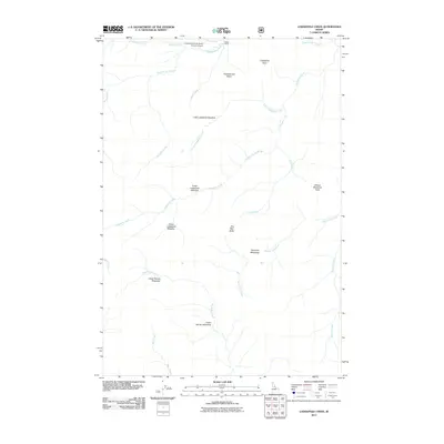
2011 Map of Lodgepole Creek
USGS Topo · Published 2011About this map
Chamberlain Basin serves as the central geographic feature of this high-elevation Idaho landscape, where high-altitude meadows and a dense network of mountain streams converge. The presence of the Chamberlain US Forest Service Airport and the Hotzel Ranch near Ranch Creek indicates a pattern of seasonal habitation and federal land management in this wilderness area. The drainage system is particularly intricate, with Lodgepole Creek and its many branches, including Little Lodgepole Creek and the Lower Lodgepole Meadow, flowing toward the interior. Significant landmarks such as One Man Butte and Moose Meadows Point provide topographic context for the surrounding system of creeks, including the creatively named Moose Jaw Creek and No Name Creek. The map documents a landscape primarily defined by these hydrological and topographic features, reflecting the remote character of Idaho County.
Find a feature on this map
26 named features on this map. Tap any name to fly to it.
Don’t see what you’re looking for? This feature index may not catch every label — zoom into the map to look around manually.
Map Details
Editions of this 2011 Lodgepole Creek Map
This is the sole edition of this map. No revisions or reprints were ever made.
Other maps of this area

1937 · Big Creek
USGS Topo · 1:48,000

1942 · Big Creek
USGS Topo · 1:62,500

1956 · Elk City
USGS Topo · 1:250,000

1960 · Elk City
USGS Topo · 1:250,000

1969 · Big Creek
USGS Topo · 1:24,000

1973 · Acorn Butte
USGS Topo · 1:24,000

1973 · Bismark Mtn
USGS Topo · 1:24,000

1974 · Meadow Of Doubt
USGS Topo · 1:24,000

1978 · Mosquito Peak
USGS Topo · 1:24,000

1978 · Arctic Point
USGS Topo · 1:24,000