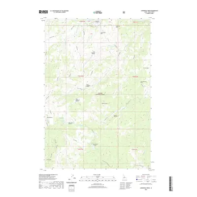
2020 Map of Lodgepole Creek
USGS Topo · Published 2020About this map
Payette National Forest encompasses this high-altitude landscape in central Idaho, where the remote Chamberlain Basin serves as a vital hub for mountain access. The presence of the Chamberlain USFS Airport at the northern edge of the basin underscores the importance of aviation in managing and reaching this backcountry terrain. Flowing through the center of the sheet, Lodgepole Creek and its tributaries, such as Little Lodgepole Creek and Hotzel Creek, drain a series of high meadows including Little Lodgepole Meadow and Lower Lodgepole Meadow. To the south and east, prominent ridgelines like Mccalla Ridge and Ramey Ridge rise above glacial features and alpine openings such as Haypress Meadows and Upper Ramey Meadows. This topography, defined by names like One Man Butte and Rock Rabbit, reflects a landscape largely shaped by wilderness management and the early pack trails of the forest service era.
Find a feature on this map
42 named features on this map. Tap any name to fly to it.
Don’t see what you’re looking for? This feature index may not catch every label — zoom into the map to look around manually.
Map Details
Editions of this 2020 Lodgepole Creek Map
This is the sole edition of this map. No revisions or reprints were ever made.
Other maps of this area

1937 · Big Creek
USGS Topo · 1:48,000

1942 · Big Creek
USGS Topo · 1:62,500

1956 · Elk City
USGS Topo · 1:250,000

1960 · Elk City
USGS Topo · 1:250,000

1969 · Big Creek
USGS Topo · 1:24,000

1973 · Acorn Butte
USGS Topo · 1:24,000

1973 · Bismark Mtn
USGS Topo · 1:24,000

1974 · Meadow Of Doubt
USGS Topo · 1:24,000

1978 · Mosquito Peak
USGS Topo · 1:24,000

1978 · Arctic Point
USGS Topo · 1:24,000