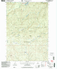
2004 Map of Lodgepole Creek
USGS Topo · Published 2007About this map
Chamberlain Basin serves as a remote hub within the Payette National Forest, dominated by the Chamberlain Landing Field Airfield. This 2004 revision of the landscape captures a network of historic backcountry access routes, including the Three Blaze Trail and the Chamberlain Trail, which navigate the steep drainage systems of Lodgepole Creek and Flossie Creek. The map documents a topography of high-altitude meadows and ridges within the Frank Church River of No Return Wilderness, characterized by family or local-interest landmarks like One Man Butte, Rock Rabbit Point, and Moose Jaw Meadow. The drainage patterns of Big Ramey Creek and McCalla Creek illustrate the untouched hydrological network that defines this protected wilderness area.
Find a feature on this map
27 named features on this map. Tap any name to fly to it.
Don’t see what you’re looking for? This feature index may not catch every label — zoom into the map to look around manually.
Map Details
Editions of this 2004 Lodgepole Creek Map
This is the sole edition of this map. No revisions or reprints were ever made.
Other maps of this area

1937 · Big Creek
USGS Topo · 1:48,000

1942 · Big Creek
USGS Topo · 1:62,500

1956 · Elk City
USGS Topo · 1:250,000

1960 · Elk City
USGS Topo · 1:250,000

1969 · Big Creek
USGS Topo · 1:24,000

1973 · Acorn Butte
USGS Topo · 1:24,000

1973 · Bismark Mtn
USGS Topo · 1:24,000

1974 · Meadow Of Doubt
USGS Topo · 1:24,000

1978 · Mosquito Peak
USGS Topo · 1:24,000

1978 · Arctic Point
USGS Topo · 1:24,000