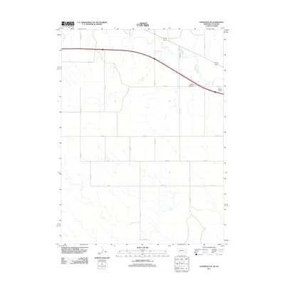
2011 Map of Lodgepole SE
USGS Topo · Published 2011About this map
Lodgepole Creek meanders across the northern portion of this Nebraska landscape, tracing a shallow valley through the high plains of Deuel County. The terrain is defined by a rigorous grid of section lines and rural thoroughfares such as Road 151 and Road 157, reflecting the systematic agricultural development typical of the region. Near the northeastern corner, Saint Joseph Cemetery stands as a quiet focal point for local genealogy and history, situated just south of the primary transport corridor. This survey also records the Chappell Rest Area - Eastbound, a modern landmark along the interstate route that bisects the northern section of the quadrangle. Outside of the creek drainages like Cole Creek, the map shows a largely open, upland environment transitioned into a productive rural grid.
Find a feature on this map
16 named features on this map. Tap any name to fly to it.
Don’t see what you’re looking for? This feature index may not catch every label — zoom into the map to look around manually.
Map Details
Editions of this 2011 Lodgepole SE Map
This is the sole edition of this map. No revisions or reprints were ever made.
Other maps of this area

1899 · Sidney
USGS Topo · 1:125,000

1900 · Chappell
USGS Topo · 1:125,000

1953 · Ovid
USGS Topo · 1:24,000

1953 · Julesburg Reservoir
USGS Topo · 1:24,000

1953 · Sedgwick
USGS Topo · 1:24,000

1954 · Sterling
USGS Topo · 1:250,000

1954 · Scottsbluff
USGS Topo · 1:250,000

1958 · Scottsbluff
USGS Topo · 1:250,000

1958 · Sterling
USGS Topo · 1:250,000

1961 · Chappell
USGS Topo · 1:24,000