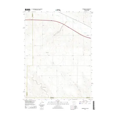
2014 Map of Lodgepole SE
USGS Topo · Published 2014About this map
Lodgepole Creek meanders through the northeastern corner of this high plains landscape, where the Nebraska-Colorado border meets. This rural expanse in Deuel County is defined by the stark drainage patterns of Sand Draw and Sedgwick Draw, which carve through the terrain south of the creek valley. Human settlement is sparse, marked primarily by a precise grid of rural routes including Road 155 and Road 161 that bisect the open country. A significant local landmark, the Saint Joseph Cemetery, sits near the northern boundary, serving as a quiet witness to the generations who have farmed and ranched this borderland. The map provides a clear view of the transition from the creek bottomlands to the higher, arid draws that characterize the region's geography.
Find a feature on this map
19 named features on this map. Tap any name to fly to it.
Don’t see what you’re looking for? This feature index may not catch every label — zoom into the map to look around manually.
Map Details
Editions of this 2014 Lodgepole SE Map
This is the sole edition of this map. No revisions or reprints were ever made.
Other maps of this area

1899 · Sidney
USGS Topo · 1:125,000

1900 · Chappell
USGS Topo · 1:125,000

1953 · Ovid
USGS Topo · 1:24,000

1953 · Julesburg Reservoir
USGS Topo · 1:24,000

1953 · Sedgwick
USGS Topo · 1:24,000

1954 · Sterling
USGS Topo · 1:250,000

1954 · Scottsbluff
USGS Topo · 1:250,000

1958 · Scottsbluff
USGS Topo · 1:250,000

1958 · Sterling
USGS Topo · 1:250,000

1961 · Chappell
USGS Topo · 1:24,000