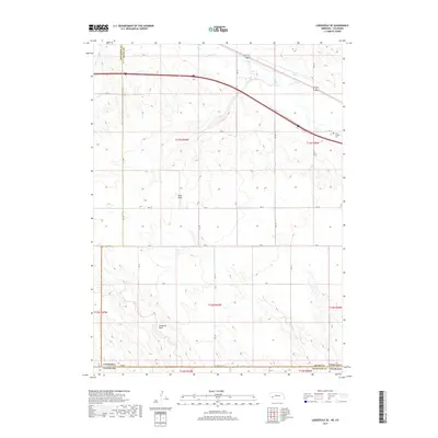
2017 Map of Lodgepole SE
USGS Topo · Published 2017About this map
The high plains borderland between Nebraska and Colorado is defined here by the winding course of Lodgepole Cr and the expansive drainage of Sand Draw. This agricultural and rangeland landscape, captured in 2017, showcases the geometric precision of the Public Land Survey System as it meets the more fluid topographies of Sedgwick Draw and Cow Cr. Near the eastern edge of the map, Saint Joseph Cem serves as a small but significant landmark for local genealogy, situated just south of the primary transportation corridor that cuts across the northern half of the sheet. The map documents the rural infrastructure of Deuel County, primarily composed of an extensive grid of county roads such as RD 14 and RD 157 that navigate the varied terrain of the surrounding townships.
Find a feature on this map
25 named features on this map. Tap any name to fly to it.
Don’t see what you’re looking for? This feature index may not catch every label — zoom into the map to look around manually.
Map Details
Editions of this 2017 Lodgepole SE Map
This is the sole edition of this map. No revisions or reprints were ever made.
Other maps of this area

1899 · Sidney
USGS Topo · 1:125,000

1900 · Chappell
USGS Topo · 1:125,000

1953 · Ovid
USGS Topo · 1:24,000

1953 · Julesburg Reservoir
USGS Topo · 1:24,000

1953 · Sedgwick
USGS Topo · 1:24,000

1954 · Sterling
USGS Topo · 1:250,000

1954 · Scottsbluff
USGS Topo · 1:250,000

1958 · Scottsbluff
USGS Topo · 1:250,000

1958 · Sterling
USGS Topo · 1:250,000

1961 · Chappell
USGS Topo · 1:24,000