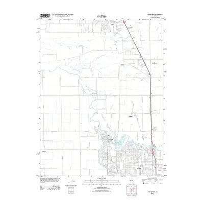
2012 Map of Lodi North
USGS Topo · Published 2012About this map
The Mokelumne River carves a winding path through the heart of this Central Valley agricultural landscape, defining the boundaries between several distinct communities in the early 21st century. To the north, the growing city of Galt is anchored by the Galt-Arno Cem, while the southern portion of the map is dominated by the grid of Lodi. Between these centers, smaller agricultural hubs such as Acampo, Collierville, and Urgon are linked by a dense network of country roads like E Peltier Rd and W Jahant Rd. The presence of Liberty Cem and family-named landmarks like Palmer Farms indicates a deeply rooted local history. The map also captures the recreational and transit infrastructure of the era, from the Lodi Airport to the Dry Creek Ranch Golf Course and the riparian ecosystems around Tracy Lake and Smith Lake.
Find a feature on this map
131 named features on this map. Tap any name to fly to it.
Don’t see what you’re looking for? This feature index may not catch every label — zoom into the map to look around manually.
Map Details
Editions of this 2012 Lodi North Map
This is the sole edition of this map. No revisions or reprints were ever made.
Other maps of this area

1894 · Lodi
USGS Topo · 1:125,000

1908 · Waterloo
USGS Topo · 1:31,680

1908 · Lockeford
USGS Topo · 1:31,680

1909 · Clay
USGS Topo · 1:31,680

1910 · New Hope
USGS Topo · 1:31,680

1910 · Castle
USGS Topo · 1:31,680

1910 · Woodbridge
USGS Topo · 1:31,680

1910 · Bruceville
USGS Topo · 1:31,680

1910 · Headreach
USGS Topo · 1:31,680

1910 · Galt
USGS Topo · 1:31,680