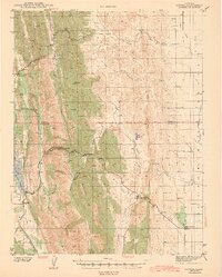
1943 Map of Lodoga
USGS Topo · Published 1943About this map
Lodoga and the surrounding foothills of the Inner Coast Ranges are captured here during the early 1940s, a landscape defined by the transition from steep ridges to the western edge of the Sacramento Valley. The settlement of Lodoga sits near the East Fork Reservoir, while to the east, the map traces the hydraulic development of the region through the Central Irrigation Canal. This era shows a rural infrastructure of windmills and small schoolhouses like Black Mtn Sch that served isolated ranching families.
Find a feature on this map
38 named features on this map. Tap any name to fly to it.
Don’t see what you’re looking for? This feature index may not catch every label — zoom into the map to look around manually.
Map Details
Editions of this 1943 Lodoga Map
2 editions found

Other maps of this area

1904 · Logan Creek
USGS Topo · 1:24,000

1904 · Sites
USGS Topo · 1:24,000

1905 · Fairview
USGS Topo · 1:24,000

1906 · Maxwell
USGS Topo · 1:62,500

1906 · Willows
USGS Topo · 1:62,500

1907 · Colusa
USGS Topo · 1:62,500

1917 · Kurand
USGS Topo · 1:31,680

1917 · Lyman
USGS Topo · 1:31,680

1917 · Logandale
USGS Topo · 1:31,680

1917 · Sites
USGS Topo · 1:31,680