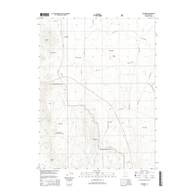
2014 Map of Lofgreen
USGS Topo · Published 2014About this map
Lofgreen and the northern reaches of the Wasatch National Forest define this high-altitude landscape in Tooele County. The terrain transitions from the elevated Vernon Hills in the northwest across the wide expanses of Sharpes Valley and Rush Valley. A network of rural routes and historical infrastructure, including Dunbar Rd and the Railroad Bed Rd, indicates a long-standing reliance on overland transport through these basins. Waterways such as Sabie Cr and Boulter Cr descend from the southern ridges, occasionally disappearing into the valley floor. The map captures small ranching or rail-related outposts like Pehrson and Dunbar, reflecting the sparse but enduring settlement patterns of the eastern Great Basin. Significant geographic markers like Twelve Mile Pass Rd and Sabie Gulch Rd further delineate the rugged travel corridors used by generations of local residents.
Find a feature on this map
32 named features on this map. Tap any name to fly to it.
Don’t see what you’re looking for? This feature index may not catch every label — zoom into the map to look around manually.
Map Details
Editions of this 2014 Lofgreen Map
This is the sole edition of this map. No revisions or reprints were ever made.
Other maps of this area

1885 · Sevier Desert
USGS Topo · 1:250,000

1885 · Tooele Valley
USGS Topo · 1:250,000

1947 · Fivemile Pass
USGS Topo · 1:62,500

1947 · Boulter Peak
USGS Topo · 1:24,000

1949 · Fivemile Pass
USGS Topo · 1:24,000

1953 · Tooele
USGS Topo · 1:250,000

1953 · Delta
USGS Topo · 1:250,000

1954 · Tintic Junction
USGS Topo · 1:24,000

1955 · Tooele
USGS Topo · 1:250,000

1958 · Delta
USGS Topo · 1:250,000