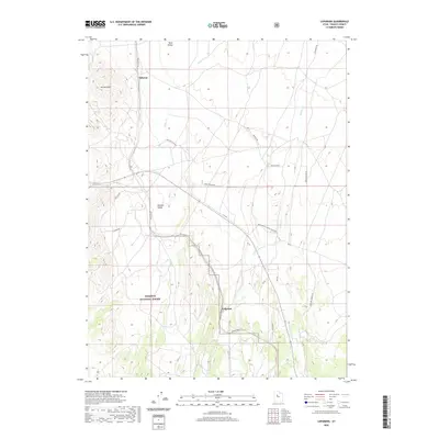
2020 Map of Lofgreen
USGS Topo · Published 2020About this map
Wasatch National Forest boundaries descend into the high desert landscape of Tooele County, Utah, where the arid basins of Rush Valley and Sharpes Valley meet. This 2020 survey records a sparsely populated but deeply connected terrain, defined by the settlements of Lofgreen and Pehrson. The map illustrates a transition from the elevated Vernon Hills down to the level expanses of Boulter Flats, providing an essential look at how modern land management and recreational access shape this part of the state.
Find a feature on this map
28 named features on this map. Tap any name to fly to it.
Don’t see what you’re looking for? This feature index may not catch every label — zoom into the map to look around manually.
Map Details
Editions of this 2020 Lofgreen Map
This is the sole edition of this map. No revisions or reprints were ever made.
Other maps of this area

1885 · Sevier Desert
USGS Topo · 1:250,000

1885 · Tooele Valley
USGS Topo · 1:250,000

1947 · Fivemile Pass
USGS Topo · 1:62,500

1947 · Boulter Peak
USGS Topo · 1:24,000

1949 · Fivemile Pass
USGS Topo · 1:24,000

1953 · Tooele
USGS Topo · 1:250,000

1953 · Delta
USGS Topo · 1:250,000

1954 · Tintic Junction
USGS Topo · 1:24,000

1955 · Tooele
USGS Topo · 1:250,000

1958 · Delta
USGS Topo · 1:250,000