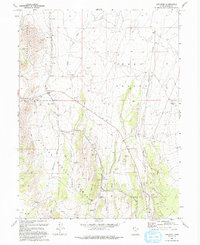
1993 Map of Lofgreen
USGS Topo · Published 1993About this map
Lofgreen sits at the base of the Wasatch National Forest where the high desert terrain of the Vernon Hills meets the broad expanse of Rush Valley. This 1993 edition, based on earlier surveys, details a landscape defined by ranching and resource extraction. The Union Pacific rail line cuts through the valley, providing a vital connection for scattered settlements like Pehrson and Dunbar. To the east, the ghost of industry remains at Scranton, while the map documents numerous Prospect sites, Quarries, and a Gravel Pit along the mountain flanks. Water remains the critical factor for survival in this arid region, marked by the courses of Sabie Creek and Boulter Creek, as well as isolated infrastructure like Cummings Well and various unnamed springs. The map provides an essential record of family-named landmarks and the network of 4wd tracks that link these remote outposts.
Find a feature on this map
24 named features on this map. Tap any name to fly to it.
Don’t see what you’re looking for? This feature index may not catch every label — zoom into the map to look around manually.
Map Details
Editions of this 1993 Lofgreen Map
This is the sole edition of this map. No revisions or reprints were ever made.
Other maps of this area

1885 · Sevier Desert
USGS Topo · 1:250,000

1885 · Tooele Valley
USGS Topo · 1:250,000

1947 · Fivemile Pass
USGS Topo · 1:62,500

1947 · Boulter Peak
USGS Topo · 1:24,000

1949 · Fivemile Pass
USGS Topo · 1:24,000

1953 · Tooele
USGS Topo · 1:250,000

1953 · Delta
USGS Topo · 1:250,000

1954 · Tintic Junction
USGS Topo · 1:24,000

1955 · Tooele
USGS Topo · 1:250,000

1958 · Delta
USGS Topo · 1:250,000