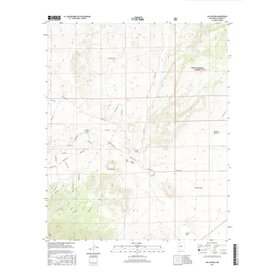
2017 Map of Log Canyon
USGS Topo · Published 2017About this map
Cibola National Forest encompasses the eastern portion of this high-altitude landscape, where the terrain breaks into dramatic drainages including Log Canyon, Sugarloaf Canyon, and Z Slash Canyon. The western half of the region is characterized by a network of rural residential roads and private ranching interests, centered around the Happy Mountain Airport and its associated Airstrip Rd. A complex system of named tracks like Bluebird Ln, Barrego Dr, and Wilderness Way indicates modern land division and rural development patterns in this corner of Catron County. Significant geographic markers such as Horse Mtn and the seasonal waters of Crosby Springs provide critical orientation points in an area defined by its deep draws and ridges, including Pino Draw and Nester Draw.
Find a feature on this map
45 named features on this map. Tap any name to fly to it.
Don’t see what you’re looking for? This feature index may not catch every label — zoom into the map to look around manually.
Map Details
Editions of this 2017 Log Canyon Map
This is the sole edition of this map. No revisions or reprints were ever made.
Other maps of this area

1918 · Pelona
USGS Topo · 1:125,000

1954 · Tularosa
USGS Topo · 1:250,000

1954 · Clifton
USGS Topo · 1:250,000

1954 · Saint Johns
USGS Topo · 1:250,000

1954 · Socorro
USGS Topo · 1:250,000

1957 · Clifton
USGS Topo · 1:250,000

1957 · Saint Johns
USGS Topo · 1:250,000

1958 · Socorro
USGS Topo · 1:250,000

1958 · Clifton
USGS Topo · 1:250,000

1958 · Tularosa
USGS Topo · 1:250,000