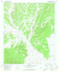
1981 Map of Log Canyon
USGS Topo · Published 1981About this map
Cibola National Forest boundaries encompass much of this high-altitude landscape in Catron County, where a network of dry washes and canyons defines the drainage patterns of the era. The topography is dominated by the intersecting paths of Log Canyon, Slash Canyon, and Sugarloaf Canyon, with the primary transit route provided by Greens Gap Road. Water access in this arid environment is limited to specific points such as Texas Spring and Oak Spring, along with ranching infrastructure like the Agua Fria Windmill and Henderson Two Section Well.
Find a feature on this map
14 named features on this map. Tap any name to fly to it.
Don’t see what you’re looking for? This feature index may not catch every label — zoom into the map to look around manually.
Map Details
Editions of this 1981 Log Canyon Map
This is the sole edition of this map. No revisions or reprints were ever made.
Other maps of this area

1918 · Pelona
USGS Topo · 1:125,000

1954 · Tularosa
USGS Topo · 1:250,000

1954 · Clifton
USGS Topo · 1:250,000

1954 · Saint Johns
USGS Topo · 1:250,000

1954 · Socorro
USGS Topo · 1:250,000

1957 · Clifton
USGS Topo · 1:250,000

1957 · Saint Johns
USGS Topo · 1:250,000

1958 · Socorro
USGS Topo · 1:250,000

1958 · Clifton
USGS Topo · 1:250,000

1958 · Tularosa
USGS Topo · 1:250,000