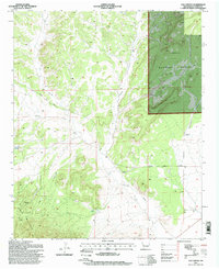
1995 Map of Log Canyon
USGS Topo · Published 1998About this map
Cibola National Forest encompasses the eastern half of this high-country landscape, where the terrain is defined by complex drainage systems and isolated ranching outposts. The network of ephemeral water sources, such as Texas Spring, Oak Spring, and the Agua Fria Windmill, underscores the importance of water management in this arid New Mexico environment. Ranching life is documented by the presence of Bull Ranch near Slash Canyon and the Thurmond Ranch to the southwest, indicating the continued human adaptation to the rugged topography of Log Canyon.
Find a feature on this map
16 named features on this map. Tap any name to fly to it.
Don’t see what you’re looking for? This feature index may not catch every label — zoom into the map to look around manually.
Map Details
Editions of this 1995 Log Canyon Map
This is the sole edition of this map. No revisions or reprints were ever made.
Other maps of this area

1918 · Pelona
USGS Topo · 1:125,000

1954 · Tularosa
USGS Topo · 1:250,000

1954 · Clifton
USGS Topo · 1:250,000

1954 · Saint Johns
USGS Topo · 1:250,000

1954 · Socorro
USGS Topo · 1:250,000

1957 · Clifton
USGS Topo · 1:250,000

1957 · Saint Johns
USGS Topo · 1:250,000

1958 · Socorro
USGS Topo · 1:250,000

1958 · Clifton
USGS Topo · 1:250,000

1958 · Tularosa
USGS Topo · 1:250,000