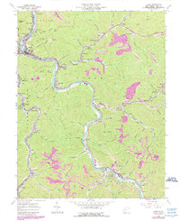
1963 Map of Logan
USGS Topo · Published 1989About this map
The Guyandotte River winds through the heart of the southern West Virginia coalfields, anchoring a dense network of mountain settlements and industrial sites. In the early 1960s, the river corridor was a busy artery of the Chesapeake and Ohio railroad, serving communities from Aracoma and Peach Creek in the north to Earling and Taplin in the south. The map documents the extensive reach of the mining industry, with numerous Strip Mines and an Abandoned Mine shown in the hills above Dingess Run and Rich Creek.
Find a feature on this map
92 named features on this map. Tap any name to fly to it.
Don’t see what you’re looking for? This feature index may not catch every label — zoom into the map to look around manually.
Map Details
Editions of this 1963 Logan Map
4 editions found
Other maps of this area

1887 · Warfield
USGS Topo · 1:125,000

1891 · Oceana
USGS Topo · 1:125,000

1891 · Warfield
USGS Topo · 1:125,000

1893 · Oceana
USGS Topo · 1:125,000

1898 · Oceana
USGS Topo · 1:125,000

1909 · Matewan
USGS Topo · 1:48,000

1909 · Gilbert
USGS Topo · 1:48,000

1910 · Holden
USGS Topo · 1:48,000

1912 · Gilbert
USGS Topo · 1:62,500

1912 · Holden
USGS Topo · 1:62,500