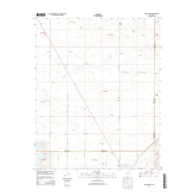
2013 Map of Logan North
USGS Topo · Published 2013About this map
Bates Place and a network of family-named ranching outposts define this high plains landscape along the Harding and Quay county line. The terrain is a vast expanse of range land punctuated by vital water sources, including West Sand Springs and dozens of named wells such as Hawkins Well, Nelson Well, and McFarland Well. This density of named wells illustrates the critical nature of groundwater for livestock operations in the semi-arid eastern New Mexico climate.
Find a feature on this map
71 named features on this map. Tap any name to fly to it.
Don’t see what you’re looking for? This feature index may not catch every label — zoom into the map to look around manually.
Map Details
Editions of this 2013 Logan North Map
This is the sole edition of this map. No revisions or reprints were ever made.
Other maps of this area

1930 · Tucumcari
USGS Topo · 1:125,000

1954 · Tucumcari
USGS Topo · 1:250,000

1958 · Tucumcari
USGS Topo · 1:250,000

1962 · Logan
USGS Topo · 1:62,500

1966 · Lockney
USGS Topo · 1:24,000

1966 · Mc Carty Ranch
USGS Topo · 1:24,000

1968 · Hudson
USGS Topo · 1:24,000

1968 · Montesito Creek
USGS Topo · 1:24,000
1969 · Fuentes Ranch
USGS Topo · 1:24,000
1989 · Tuscocoillo Canyon
USGS Topo · 1:24,000