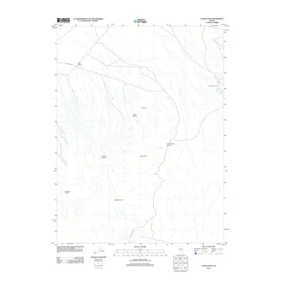
2011 Map of Logan Peak
USGS Topo · Published 2011About this map
Logan Peak and Table Mountain anchor this arid Churchill County landscape, where water sources dictate the sparse human footprint. The geography is defined by a series of dramatic drainages including Logan Canyon, New York Canyon, and Big Ben Canyon. Small pockets of activity appear at isolated outposts like Fencemaker Camp and the Buena Vista Windmill in the northwest. The presence of Logan Spring, Kitten Springs, and Mustang Spring highlights the critical importance of reliable water in this high-desert environment. Much of the local travel follows the unpaved corridor of Kitten Springs Rd, which snakes through the western hills toward Cottonwood Creek. This topography illustrates the challenges of 21st-century land use in the Great Basin, where namesake peaks and named springs remain the primary landmarks for navigation and settlement.
Find a feature on this map
14 named features on this map. Tap any name to fly to it.
Don’t see what you’re looking for? This feature index may not catch every label — zoom into the map to look around manually.
Map Details
Editions of this 2011 Logan Peak Map
This is the sole edition of this map. No revisions or reprints were ever made.
Other maps of this area

1908 · Carson Sink
USGS Topo · 1:250,000

1910 · Carson Sink
USGS Topo · 1:250,000

1931 · Lovelock
USGS Topo · 1:250,000

1932 · Sonoma Range
USGS Topo · 1:250,000

1935 · Lovelock
USGS Topo · 1:250,000

1939 · Sonoma Range
USGS Topo · 1:250,000

1954 · Buffalo Mtn
USGS Topo · 1:62,500

1955 · Millett
USGS Topo · 1:250,000

1955 · Lovelock
USGS Topo · 1:250,000

1955 · Winnemucca
USGS Topo · 1:250,000