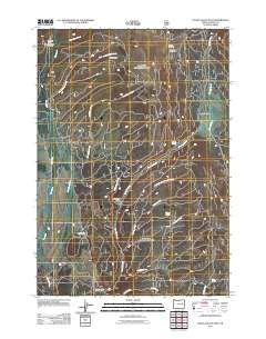
2011 Map of Logan Valley East
USGS Topo · Published 2011About this map
Logan Valley serves as the central focal point of this Grant County high-country landscape, where the headwaters of the Malheur River begin their descent. This 2011 survey documents a remote backcountry network of Forest Service infrastructure, including isolated outposts like French Cabin, Snowshoe Camp, and Sky Line Camp. The terrain is defined by elevated clearings such as Summit Prairie and the depression of Corral Basin. Water is the dominant feature, with a dense drainage system of named creeks including Bosonberg Creek, Summit Creek, and Wickiup Creek feeding into the larger valley system. Access to these remote reaches is maintained via the Snowshoe Trailhead and Skyline Trailhead, reflecting the area's modern role in forest management and wilderness recreation.
Find a feature on this map
23 named features on this map. Tap any name to fly to it.
Don’t see what you’re looking for? This feature index may not catch every label — zoom into the map to look around manually.
Map Details
Editions of this 2011 Logan Valley East Map
This is the sole edition of this map. No revisions or reprints were ever made.
Other maps of this area

1908 · Ironside Mountain
USGS Topo · 1:125,000

1955 · Canyon City
USGS Topo · 1:250,000

1959 · Canyon City
USGS Topo · 1:250,000

1959 · Prairie City
USGS Topo · 1:62,500

1961 · Logan Valley
USGS Topo · 1:62,500

1970 · Flag Prairie
USGS Topo · 1:62,500
1972 · Little Baldy Mnt.
USGS Topo · 1:24,000

1978 · John Day
USGS Topo · 1:100,000
1988 · Logan Valley East
USGS Topo · 1:24,000
1988 · Magpie Table
USGS Topo · 1:24,000