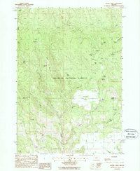
1988 Map of Magpie Table
USGS Topo · Published 1988About this map
Malheur National Forest dominates this landscape on the boundary between Grant and Harney counties. This 1980s topography reveals a high-elevation environment defined by volcanic features and an extensive network of springs and gulches. Magpie Table and Glass Mountain serve as primary landmarks, providing a clear view of the area's geological relief. The presence of the Frazier Point Lookout Tower indicates the area's strategic importance for forest management and fire observation during this era.
Find a feature on this map
41 named features on this map. Tap any name to fly to it.
Don’t see what you’re looking for? This feature index may not catch every label — zoom into the map to look around manually.
Map Details
Editions of this 1988 Magpie Table Map
This is the sole edition of this map. No revisions or reprints were ever made.
Other maps of this area

1955 · Burns
USGS Topo · 1:250,000

1955 · Canyon City
USGS Topo · 1:250,000

1958 · Burns
USGS Topo · 1:250,000

1959 · Burns
USGS Topo · 1:250,000

1959 · Canyon City
USGS Topo · 1:250,000

1961 · Calamity Butte
USGS Topo · 1:62,500

1961 · Logan Valley
USGS Topo · 1:62,500

1961 · Seneca
USGS Topo · 1:62,500

1968 · Van
USGS Topo · 1:62,500

1978 · John Day
USGS Topo · 1:100,000