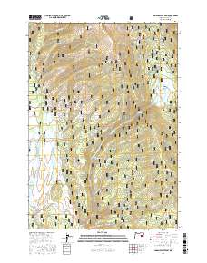
2017 Map of Logan Valley East
USGS Topo · Published 2017About this map
Malheur National Forest dominates this section of Grant County, Oregon, where the high-altitude terrain of Logan Valley meets the surrounding timberlands. The landscape is defined by its extensive drainage network, with the Malheur River and several tributaries such as Snowshoe Cr and Bosonberg Cr carving through the mountains. Settlement is sparse, replaced by a complex system of logging and access routes like Natl Forest Develop Road 16 Rd, which connects the higher ridges to the valley floor. Small, localized features such as Basket Spring, Wickiup Spring, and Joice Spring provide essential water sources in the dry upland basins. The map also highlights traditional grazing and hunting grounds, including Summit Prairie and the sheltered Corral Basin, illustrating the region's long-standing connection to forestry and remote land management.
Find a feature on this map
34 named features on this map. Tap any name to fly to it.
Don’t see what you’re looking for? This feature index may not catch every label — zoom into the map to look around manually.
Map Details
Editions of this 2017 Logan Valley East Map
This is the sole edition of this map. No revisions or reprints were ever made.
Other maps of this area

1908 · Ironside Mountain
USGS Topo · 1:125,000

1955 · Canyon City
USGS Topo · 1:250,000

1959 · Canyon City
USGS Topo · 1:250,000

1959 · Prairie City
USGS Topo · 1:62,500

1961 · Logan Valley
USGS Topo · 1:62,500

1970 · Flag Prairie
USGS Topo · 1:62,500
1972 · Little Baldy Mnt.
USGS Topo · 1:24,000

1978 · John Day
USGS Topo · 1:100,000
1988 · Logan Valley East
USGS Topo · 1:24,000
1988 · Magpie Table
USGS Topo · 1:24,000