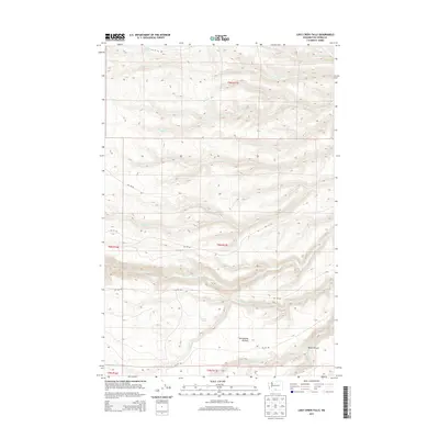
2013 Map of Logy Creek Falls
USGS Topo · Published 2013About this map
Logy Creek Falls serves as a primary geographical anchor in this Yakima County landscape, where water drainage patterns reveal a complex network of seasonal and perennial streams. The topography is defined by the carved depths of Black Canyon and the open expanse of Tannawasha Pasture, illustrating the distinct land use and terrain character of this region. Bureau of Indian Affairs transit routes, such as Bia 172 RD and Bia 160 RD, navigate the high-elevation ridges and valley floors, connecting remote points across the township boundaries.
Find a feature on this map
25 named features on this map. Tap any name to fly to it.
Don’t see what you’re looking for? This feature index may not catch every label — zoom into the map to look around manually.
Map Details
Editions of this 2013 Logy Creek Falls Map
This is the sole edition of this map. No revisions or reprints were ever made.
Other maps of this area

1937 · White Swan
USGS Topo · 1:125,000

1950 · Yakima
USGS Topo · 1:250,000

1958 · Toppenish Mtn.
USGS Topo · 1:24,000

1958 · Fort Simcoe
USGS Topo · 1:24,000

1958 · Fort Simcoe
USGS Topo · 1:62,500

1958 · Harrah SE
USGS Topo · 1:24,000

1958 · Yakima
USGS Topo · 1:250,000

1961 · Yakima
USGS Topo · 1:250,000
1965 · Kusshi Creek
USGS Topo · 1:24,000
1965 · Logy Creek
USGS Topo · 1:62,500