
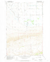
1958 Map of Harrah SE
USGS Topo · Published 1960About this map
Toppenish Ridge dominates the southern landscape of this Yakima County region, providing a sharp topographic contrast to the heavily engineered irrigation plains to the north. The 1958 landscape reveals an intricate water management system essential for local agriculture, marked by a dense network of features like the Mud Lake Drain, Lateral Pipeline, and several diversion structures. A Landing Strip and a Powerhouse near Mud Lake suggest the infrastructure supporting rural operations during the mid-century.
Find a feature on this map
27 named features on this map. Tap any name to fly to it.
Don’t see what you’re looking for? This feature index may not catch every label — zoom into the map to look around manually.
Map Details
Editions of this 1958 Harrah SE Map
2 editions found
Other maps of this area

1910 · Zillah
USGS Topo · 1:125,000

1937 · White Swan
USGS Topo · 1:125,000

1950 · Yakima
USGS Topo · 1:250,000

1958 · Toppenish SW
USGS Topo · 1:24,000

1958 · Toppenish Mtn.
USGS Topo · 1:24,000

1958 · Harrah
USGS Topo · 1:24,000

1958 · White Swan
USGS Topo · 1:24,000
1958 · Wapato
USGS Topo · 1:24,000

1958 · Yakima
USGS Topo · 1:250,000

1961 · Yakima
USGS Topo · 1:250,000