
1958 Map of Toppenish Mtn.
USGS Topo · Published 1960About this map
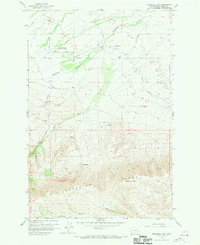
The Yakima Indian Christian Mission stands as a focal point of settlement on the lower slopes above the valley floor in the late 1950s. This landscape is defined by the dramatic rise of Toppenish Ridge, culminating at the summit of Toppenish Mtn. Water management is central to the area's character, with Toppenish Creek and Mill Creek winding through the terrain, supplemented by numerous siphons and canals such as the Shaker Canal. A network of rural routes, including Mission Road, Fort Simcoe Road, and Adams Highway, connects the scattered farmsteads and gravel pits to the surrounding Yakima County region. High on the ridge, the presence of Olney Lake and remote water sources like Seattle Spring illustrate the rugged geography that borders the more developed agricultural flats.
Find a feature on this map
18 named features on this map. Tap any name to fly to it.
Don’t see what you’re looking for? This feature index may not catch every label — zoom into the map to look around manually.
Map Details
Editions of this 1958 Toppenish Mtn. Map
2 editions found
Other maps of this area

1937 · White Swan
USGS Topo · 1:125,000

1950 · Yakima
USGS Topo · 1:250,000

1958 · Harrah
USGS Topo · 1:24,000

1958 · Fort Simcoe
USGS Topo · 1:24,000

1958 · Fort Simcoe
USGS Topo · 1:62,500

1958 · White Swan
USGS Topo · 1:24,000
1958 · Medicine Valley
USGS Topo · 1:24,000

1958 · Harrah SE
USGS Topo · 1:24,000

1958 · Yakima
USGS Topo · 1:250,000

1961 · Yakima
USGS Topo · 1:250,000