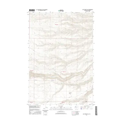
2017 Map of Logy Creek Falls
USGS Topo · Published 2017About this map
Logy Creek Falls serves as a prominent landmark in this Yakima County landscape, where the waters of Logy Cr drop through a series of dramatic elevation changes. The area is defined by a dense network of drainages including Fortyday Cr, Knockout Cr, and the ironically named Lousy Cr. These seasonal and perennial streams have carved the terrain, most notably at Black Canyon near the confluence with Yatama Cr.
Find a feature on this map
25 named features on this map. Tap any name to fly to it.
Don’t see what you’re looking for? This feature index may not catch every label — zoom into the map to look around manually.
Map Details
Editions of this 2017 Logy Creek Falls Map
This is the sole edition of this map. No revisions or reprints were ever made.
Other maps of this area

1937 · White Swan
USGS Topo · 1:125,000

1950 · Yakima
USGS Topo · 1:250,000

1958 · Toppenish Mtn.
USGS Topo · 1:24,000

1958 · Fort Simcoe
USGS Topo · 1:24,000

1958 · Fort Simcoe
USGS Topo · 1:62,500

1958 · Harrah SE
USGS Topo · 1:24,000

1958 · Yakima
USGS Topo · 1:250,000

1961 · Yakima
USGS Topo · 1:250,000
1965 · Kusshi Creek
USGS Topo · 1:24,000
1965 · Logy Creek
USGS Topo · 1:62,500