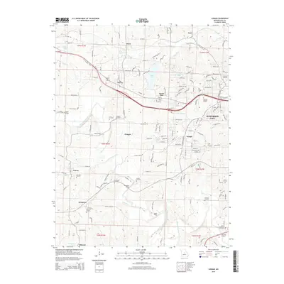
2015 Map of Lohman
USGS Topo · Published 2015About this map
Binder Lake and Lake Claradean center this landscape west of Jefferson City, where the terrain transitions from suburban outskirts to the rural drainage basins of the Moreau River. Smaller settlements like St. Martins, Apache Flats, and Lohman are interconnected by a network of historic routes such as Old Stage Rd, while the southern reaches follow the winding course of the North Moreau Creek. Genealogists will find a high concentration of burial sites, ranging from family-named plots like Wilkerson Cemetery and Stone Cemetery to larger religious and memorial grounds such as the Islamic Cemetery of Mid Missouri and Hawthorn Memorial Gardens. Several stream crossings, including Hemstreet Bridge and Saddle Bridge, mark the points where local roads negotiate the deep draws of the Kautsch Br and Bennie Br.
Find a feature on this map
157 named features on this map. Tap any name to fly to it.
Don’t see what you’re looking for? This feature index may not catch every label — zoom into the map to look around manually.
Map Details
Editions of this 2015 Lohman Map
This is the sole edition of this map. No revisions or reprints were ever made.
Other maps of this area

1886 · Jefferson City
USGS Topo · 1:125,000

1888 · Tuscumbia
USGS Topo · 1:125,000

1894 · Tuscumbia
USGS Topo · 1:125,000

1894 · Jefferson City
USGS Topo · 1:125,000

1939 · Jefferson City
USGS Topo · 1:24,000

1939 · Jefferson City
USGS Topo · 1:62,500

1942 · Jefferson City
USGS Topo · 1:62,500

1947 · Jefferson City
USGS Topo · 1:250,000

1948 · Centertown
USGS Topo · 1:62,500

1948 · Meta
USGS Topo · 1:62,500