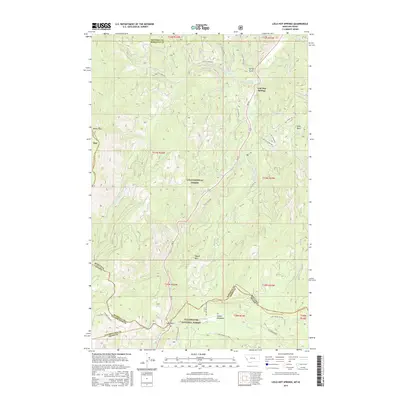
2017 Map of Lolo Hot Springs
USGS Topo · Published 2017About this map
Lolo Hot Springs serves as a primary point of interest in this high-altitude landscape where the Lolo National Forest and Clearwater National Forest meet. The geography is defined by the Bitterroot Range, centering on the crossing of the Montana and Idaho border at Lolo Pass. A complex network of Forest Service roads, including Fish Creek Rd and Lee Creek Rd, provides access to the steep terrain of Wagon Mtn and the hydrological headwaters of Lolo Cr. The map details the transition from high ridgelines like Rocky Peak to the open alpine area of Packer Meadows. Small water features such as Snowshoe Falls and Spring Gulch are noted alongside several county boundaries, illustrating the intersection of Mineral, Missoula, Clearwater, and Idaho counties in this isolated mountain corridor.
Find a feature on this map
49 named features on this map. Tap any name to fly to it.
Don’t see what you’re looking for? This feature index may not catch every label — zoom into the map to look around manually.
Map Details
Editions of this 2017 Lolo Hot Springs Map
This is the sole edition of this map. No revisions or reprints were ever made.
Other maps of this area

1911 · Lolo
USGS Topo · 1:250,000

1912 · Missoula
USGS Topo · 1:125,000

1913 · Lolo
USGS Topo · 1:250,000

1956 · Hamilton
USGS Topo · 1:250,000

1959 · Hamilton
USGS Topo · 1:250,000

1960 · Hamilton
USGS Topo · 1:250,000

1964 · Hamilton
USGS Topo · 1:250,000

1964 · Lolo Hot Springs
USGS Topo · 1:24,000

1964 · Garden Point
USGS Topo · 1:24,000

1964 · West Fork Butte
USGS Topo · 1:24,000