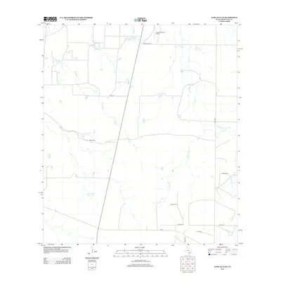
2013 Map of Loma Alta NE
USGS Topo · Published 2013About this map
Hasete Ranch and Atkinson Ranch anchor this corner of McMullen County, where the landscape is defined by a dendritic network of seasonal creek beds and intermittent water sources. The drainages of Leopard Cr, Elm Cr, and Cow Cr converge across the terrain, interspersed with localized watering points like Red Gate Tank and Hasete Lake. In a region dominated by ranching and large landholdings, transportation is restricted to a few key arteries such as Ranch Road 1962 and FM-624. The presence of the Arrowhead Ranch Airport underscores the vast distances typical of this South Texas brush country, while named landmarks like Devils Waterhole Cr hint at the local topography and the importance of reliable water sources in a semi-arid environment.
Find a feature on this map
21 named features on this map. Tap any name to fly to it.
Don’t see what you’re looking for? This feature index may not catch every label — zoom into the map to look around manually.
Map Details
Editions of this 2013 Loma Alta NE Map
This is the sole edition of this map. No revisions or reprints were ever made.
Other maps of this area

1920 · Mikeska
USGS Topo · 1:125,000

1929 · Simmons
USGS Topo · 1:62,500

1930 · Tilden
USGS Topo · 1:62,500

1937 · Loma Alta
USGS Topo · 1:62,500

1942 · Tilden
USGS Topo · 1:62,500

1953 · Crystal City
USGS Topo · 1:250,000

1955 · Crystal City
USGS Topo · 1:250,000

1961 · Crystal City
USGS Topo · 1:250,000

1968 · Crystal City
USGS Topo · 1:250,000
1969 · San Caja Hill
USGS Topo · 1:24,000