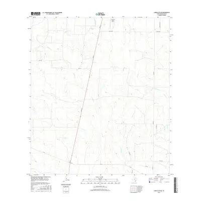
2016 Map of Loma Alta NE
USGS Topo · Published 2016About this map
Hasete Lake and the winding drainage of Elm Cr anchor the southern reach of this McMullen County landscape, characterized by the ephemeral watercourses and ranching infrastructure typical of the South Texas brush country. The map traces the long, straight trajectory of River St as it bisects the terrain, passing landmarks such as the Red Gate Tank. In the north, the Arrowhead Ranch Airport indicates modern aviation's role in managing these expansive properties.
Find a feature on this map
21 named features on this map. Tap any name to fly to it.
Don’t see what you’re looking for? This feature index may not catch every label — zoom into the map to look around manually.
Map Details
Editions of this 2016 Loma Alta NE Map
This is the sole edition of this map. No revisions or reprints were ever made.
Other maps of this area

1920 · Mikeska
USGS Topo · 1:125,000

1929 · Simmons
USGS Topo · 1:62,500

1930 · Tilden
USGS Topo · 1:62,500

1937 · Loma Alta
USGS Topo · 1:62,500

1942 · Tilden
USGS Topo · 1:62,500

1953 · Crystal City
USGS Topo · 1:250,000

1955 · Crystal City
USGS Topo · 1:250,000

1961 · Crystal City
USGS Topo · 1:250,000

1968 · Crystal City
USGS Topo · 1:250,000
1969 · San Caja Hill
USGS Topo · 1:24,000