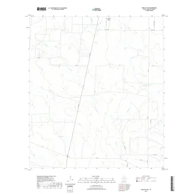
2019 Map of Loma Alta NE
USGS Topo · Published 2019About this map
Leopard Cr and Elm Cr flow through this section of the South Texas brush country, where ranching infrastructure and seasonal waterways dominate the landscape. In the northern reaches, the Arrowhead Ranch Airport sits near Red Gate Tank, while Hasete Lake provides a rare point of standing water in the western half. The network of local roads, such as Miles Rd, River St, and San Diego, reveals the enduring ranching properties that define McMullen County. To the east, the drainage system becomes more intricate with Devils Waterhole Cr and Little Cow Cr carving through the terrain. This survey provides a clear view of the modern rural infrastructure, from state-maintained routes like FM 624 to private ranch paths like Whitley Rd and Gieck Rd, highlighting the land-use patterns of the early twenty-first century.
Find a feature on this map
21 named features on this map. Tap any name to fly to it.
Don’t see what you’re looking for? This feature index may not catch every label — zoom into the map to look around manually.
Map Details
Editions of this 2019 Loma Alta NE Map
This is the sole edition of this map. No revisions or reprints were ever made.
Other maps of this area

1920 · Mikeska
USGS Topo · 1:125,000

1929 · Simmons
USGS Topo · 1:62,500

1930 · Tilden
USGS Topo · 1:62,500

1937 · Loma Alta
USGS Topo · 1:62,500

1942 · Tilden
USGS Topo · 1:62,500

1953 · Crystal City
USGS Topo · 1:250,000

1955 · Crystal City
USGS Topo · 1:250,000

1961 · Crystal City
USGS Topo · 1:250,000

1968 · Crystal City
USGS Topo · 1:250,000
1969 · San Caja Hill
USGS Topo · 1:24,000