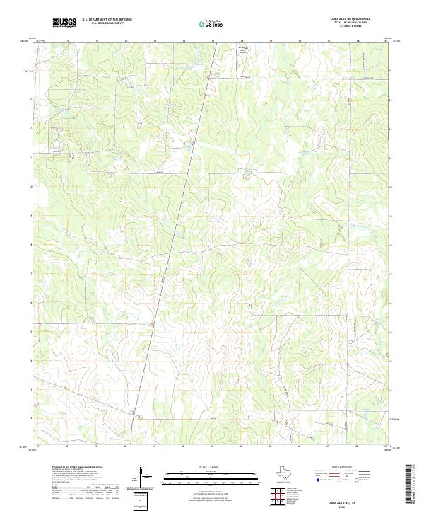
2022 Map of Loma Alta NE
USGS Topo · Published 2022About this map
Hasete Lake anchors the lower-central landscape of this South Texas region, a pocket of water in an otherwise creek-dissected ranchland. The area is defined by a sparse but deliberate network of ranch roads and state routes, including FM 624 and the intersecting River St, which cuts a nearly straight line north across the map. This 2022 survey illustrates the modern cattle and aviation infrastructure of McMullen County, notably the Arrowhead Ranch Airport situated near the northern border. Drainage patterns are dominated by seasonal watercourses like Little Leopard Cr and Little Cow Cr, many of which feed into larger systems such as Devils Waterhole Cr. The presence of features like Red Gate Tank highlights the vital role of water management in this arid cattle-country environment, where ranching names like Charlton Ranch Rd mark the local geography.
Find a feature on this map
21 named features on this map. Tap any name to fly to it.
Don’t see what you’re looking for? This feature index may not catch every label — zoom into the map to look around manually.
Map Details
Editions of this 2022 Loma Alta NE Map
This is the sole edition of this map. No revisions or reprints were ever made.
Other maps of this area

1920 · Mikeska
USGS Topo · 1:125,000

1929 · Simmons
USGS Topo · 1:62,500

1930 · Tilden
USGS Topo · 1:62,500

1937 · Loma Alta
USGS Topo · 1:62,500

1942 · Tilden
USGS Topo · 1:62,500

1953 · Crystal City
USGS Topo · 1:250,000

1955 · Crystal City
USGS Topo · 1:250,000

1961 · Crystal City
USGS Topo · 1:250,000

1968 · Crystal City
USGS Topo · 1:250,000
1969 · San Caja Hill
USGS Topo · 1:24,000