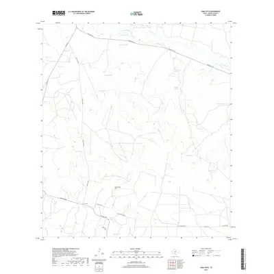
2019 Map of Loma Vista
USGS Topo · Published 2019About this map
The Leona River and Gallina Slough define the northern drainage of this arid Zavala County landscape, where water management is the primary driver of human settlement. The small community of Loma Vista serves as the focal point, situated near the intersection of several ranching roads including Ranch Rd 1867 and Loma Vista Rd. A history of family landholdings is evident in the numerous named catchment basins that dot the terrain, such as Old Zachman Tank, Carmichael Tank, and Taquache Tank. These man-made features, essential for livestock in the brush country, illustrate the reliance on localized water sources away from the main channels of Cibolo Cr and Loma Vista Cr. Genealogists will find the Loma Vista Cem south of the main settlement, resting in the shadow of the prominent Loma Vista Hill.
Find a feature on this map
31 named features on this map. Tap any name to fly to it.
Don’t see what you’re looking for? This feature index may not catch every label — zoom into the map to look around manually.
Map Details
Editions of this 2019 Loma Vista Map
This is the sole edition of this map. No revisions or reprints were ever made.
Other maps of this area

1939 · Big Wells
USGS Topo · 1:62,500

1942 · Divot
USGS Topo · 1:62,500

1953 · Crystal City
USGS Topo · 1:250,000

1955 · Crystal City
USGS Topo · 1:250,000

1956 · Woodward
USGS Topo · 1:62,500

1956 · Divot
USGS Topo · 1:62,500

1957 · Batesville
USGS Topo · 1:62,500

1961 · Crystal City
USGS Topo · 1:250,000

1968 · Crystal City
USGS Topo · 1:250,000
1972 · Batesville
USGS Topo · 1:24,000