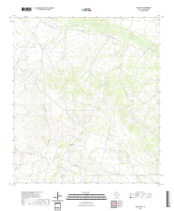
2022 Map of Loma Vista
USGS Topo · Published 2022About this map
Loma Vista Hill rises as a prominent landmark in this Zavala County landscape, where the seasonal hydrology of South Texas is marked by numerous stock tanks and drainages. The map reveals a network of water features critical to ranching operations, from the Gallina Slough and Leona River in the north to the Cibolo Cr and Burtrand Cr in the south. These names—often reflecting family history or local ecology—include Old Zachman Tank, Taquache Tank, and Carmichael Tank. Transportation routes like Ranch Rd 117 and Loma Vista Rd provide the primary framework for the area. A point of significant interest for genealogists and local historians is the Loma Vista Cem, situated near the junction of Los Ninos Rd and Ranch Rd 1867, serving as a silent anchor for the community's heritage.
Find a feature on this map
30 named features on this map. Tap any name to fly to it.
Don’t see what you’re looking for? This feature index may not catch every label — zoom into the map to look around manually.
Map Details
Editions of this 2022 Loma Vista Map
This is the sole edition of this map. No revisions or reprints were ever made.
Other maps of this area

1939 · Big Wells
USGS Topo · 1:62,500

1942 · Divot
USGS Topo · 1:62,500

1953 · Crystal City
USGS Topo · 1:250,000

1955 · Crystal City
USGS Topo · 1:250,000

1956 · Woodward
USGS Topo · 1:62,500

1956 · Divot
USGS Topo · 1:62,500

1957 · Batesville
USGS Topo · 1:62,500

1961 · Crystal City
USGS Topo · 1:250,000

1968 · Crystal City
USGS Topo · 1:250,000
1972 · Batesville
USGS Topo · 1:24,000