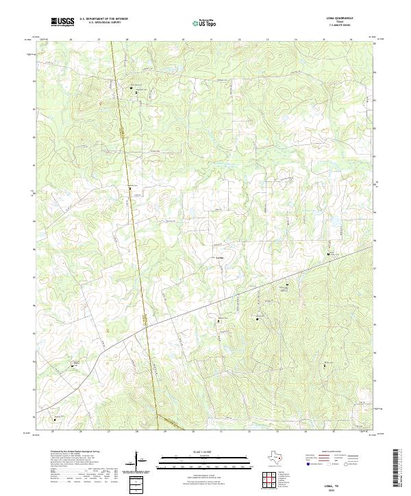
2022 Map of Loma
USGS Topo · Published 2022About this map
The settlement of Loma serves as a central point in this rural landscape where the boundaries of Walker, Grimes, and Montgomery counties meet. The area is defined by the winding course of the W Fork San Jacinto River and its numerous tributaries, including Sulphur Cr, Salty Cr, and Sand Br. This modern survey reveals a dense concentration of historical burial sites that offer significant value for genealogical research, such as the Foster Cem African American and Buck Foster Cem.
Find a feature on this map
65 named features on this map. Tap any name to fly to it.
Don’t see what you’re looking for? This feature index may not catch every label — zoom into the map to look around manually.
Map Details
Editions of this 2022 Loma Map
This is the sole edition of this map. No revisions or reprints were ever made.
Other maps of this area

1954 · Beaumont
USGS Topo · 1:250,000

1957 · Beaumont
USGS Topo · 1:250,000

1959 · San Jacinto
USGS Topo · 1:24,000

1961 · Singleton
USGS Topo · 1:24,000

1962 · Richards
USGS Topo · 1:24,000
1962 · Roans Prairie
USGS Topo · 1:24,000

1962 · Galilee
USGS Topo · 1:24,000

1963 · Bedias
USGS Topo · 1:24,000

1963 · Steep Branch
USGS Topo · 1:24,000

1963 · Crabbs Prairie
USGS Topo · 1:24,000