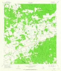
1963 Map of Loma
USGS Topo · Published 1965About this map
The West Fork San Jacinto River winds through this rural landscape in southeastern Texas, creating a complex network of drainage that includes Salty Creek, Sulphur Creek, and the West Sandy Creek. Centered on the settlement of Loma, the map reveals a rural community supported by local institutions such as Hopewell Sch, Faces Chapel, and Wesley Grove Ch. The presence of several family and community burial grounds, including Mc Cowan Cem, Mustang Cem, and Brushy Cem, provides valuable points of reference for genealogists tracing local families in this corner of Walker County near the Grimes and Montgomery county lines. The landscape is a mix of wooded areas and cleared lands, with infrastructure like a Pumping Sta, a Landing Strip, and a Flowing Well indicating the area's agricultural and industrial utility in the early 1960s.
Find a feature on this map
46 named features on this map. Tap any name to fly to it.
Don’t see what you’re looking for? This feature index may not catch every label — zoom into the map to look around manually.
Map Details
Editions of this 1963 Loma Map
This is the sole edition of this map. No revisions or reprints were ever made.
Other maps of this area

1954 · Beaumont
USGS Topo · 1:250,000

1957 · Beaumont
USGS Topo · 1:250,000

1959 · San Jacinto
USGS Topo · 1:24,000

1961 · Singleton
USGS Topo · 1:24,000

1962 · Richards
USGS Topo · 1:24,000
1962 · Roans Prairie
USGS Topo · 1:24,000

1962 · Galilee
USGS Topo · 1:24,000

1963 · Bedias
USGS Topo · 1:24,000

1963 · Steep Branch
USGS Topo · 1:24,000

1963 · Crabbs Prairie
USGS Topo · 1:24,000