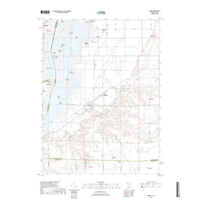
2018 Map of Lomax
USGS Topo · Published 2018About this map
The Mississippi River forms a complex boundary between Illinois and Iowa, shaping the landscape of Henderson and Lee counties. This reach is defined by a dense network of riverine features, including Craigel Slough, Turkey Chute, and numerous landforms like Burlington Island and Paddy Island. The settlement of Lomax sits as a central hub where the BNSF Railway intersects the local grid, including Main St and Aviston St.
Find a feature on this map
69 named features on this map. Tap any name to fly to it.
Don’t see what you’re looking for? This feature index may not catch every label — zoom into the map to look around manually.
Map Details
Editions of this 2018 Lomax Map
This is the sole edition of this map. No revisions or reprints were ever made.
Other maps of this area

1918 · La Harpe
USGS Topo · 1:62,500

1932 · Lomax
USGS Topo · 1:62,500

1934 · Oquawka
USGS Topo · 1:48,000

1934 · Burlington
USGS Topo · 1:48,000

1937 · Lomax
USGS Topo · 1:62,500

1940 · Oquawka
USGS Topo · 1:62,500

1940 · Burlington
USGS Topo · 1:62,500

1958 · Burlington
USGS Topo · 1:250,000

1961 · Burlington
USGS Topo · 1:250,000

1963 · Burlington
USGS Topo · 1:250,000